Mapping Solutions for 911 and Public Safety
We’re an agile, service-oriented company with the experience to solve your mapping and addressing needs.
Featured Projects

Navajo Nation
We’re more than pleased to be helping map the Navajo Nation to support a next-generation 911 system. Already our drivers have traveled more than 20,000 miles in the Navajo Nation and verified nearly 5,100 addresses in 10 chapters.

911 Missouri
SDR’s popular GIS services and software are available to Missouri 911 entities. Grants are available from the Missouri 911 Service Board for Dispatch Mapping Software and upgrades, as well as GIS improvement required for 911.
SDR has not only exceeded my expectations, but shattered them.
Leonard Redhorse III
Deputy Chief of the Navajo Police Department

That's a lot of mailboxes!
We've driven hundreds of thousands of miles. And verified oh so many addresses.
Since our inception in 1993, 
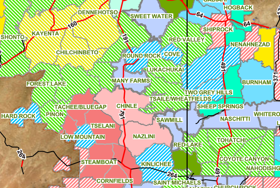
SDR has led addressing, mapping and 911 projects for more than 300 state, county, municipal, public safety and private sector clients, including nearly a dozen projects for Native American tribes and nations.
Our most popular products
SDR’s Go2It Dispatch Mapping Software now includes an interface to RapidSOS at no additional cost.
Your tool of choice to quickly solve problems, improve your data and share your mapping with constituents and stakeholders.
Simply draw the road with the imagery or GPS as reference and AddressIt automatically
calculates the low and high address ranges and address parity.
Designed to quickly plot incoming 911 calls and provide map-based recommendations for responding agencies.
New and Noteworthy


